Shorter hikes on Table Mountain
Only have a few hours?
No need to get to the top. There are many shorter back-trails on the mountain.
UPDATE: Cecilia waterfall hike on a "35 world's best hikes (that anyone can do)" list.
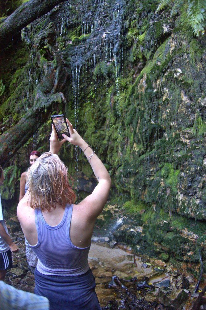
I don't know about anyone, but in terms of great short hikes, the Cecilia Waterfall loop is an excellent blend of the best of the mountain, its fynbos and forests, and Cecilia's unique dripping wall of fern and moss.
(More on the Cecilia Waterfall hike below.)
Or TRY a No-sweat ascent. Then head off from the Upper Cable Station into quieter reaches.
Catch the cable car up and get to see the famous views of the city, Lions Head and the Atlantic. Escape the crowds by hiking away from the upper cable station for a two-ish hour circular hike.
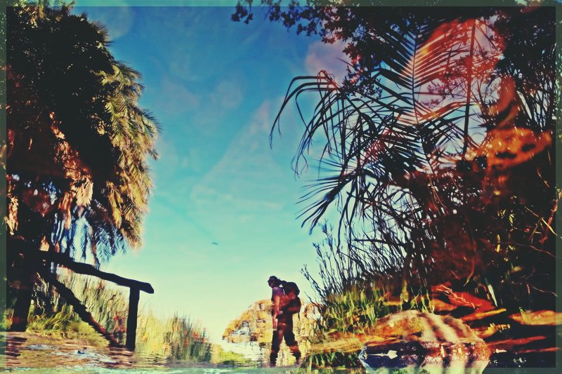
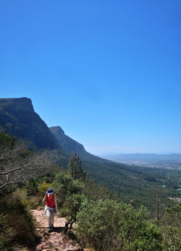
Get views of the other side of the peninsula not seen from the upper cable station. A slightly longer option is to hike into quiet Echo Valley. It is one of the least strenuous ways to get a feel of what more the mountain has to offer. Depending on route it's about a two to 3.5 hour excursion, excluding cable car rides.
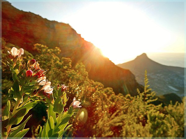
Cecilia
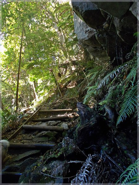
To get to Cecilia Ravine hike through gentle fynbos-lined path, then forested stream, before contouring towards Kirstenbosch, and the final challenging ascent that works up a sweat.
The ever-widening views of the city's leafy suburbs all the way out across the Cape Flats and False Bay are rewarding, then topped by the fern and mossy walls of Cecelia Waterfall.
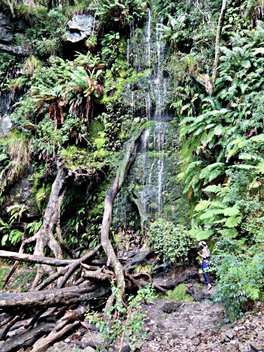
Cecilia Waterfall
Going slightly higher: Constantia Corner
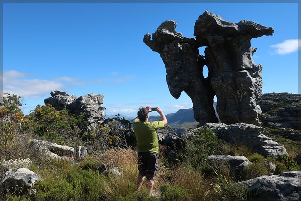
For a 3 to 4 hour walk to higher reaches, with some thrilling scrambling, there is the Constantia Corner route via Camel Rock (pictured below.) Vantage points on this trail get views into Orange Kloof and Disa Gorge.
Take the Devil's Lovely Contours
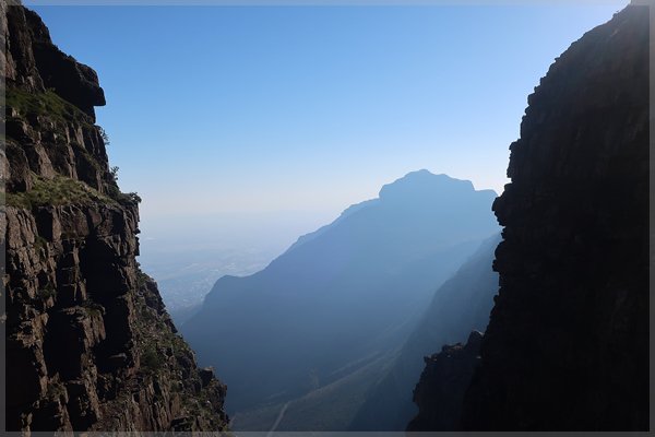
Closer to the city center is a hike up to the contour paths around Devil's Peak (as seen in the pic above from Platteklip Gorge.)
There are three levels of contour path, so you can choose how high you'd like to climb as you go.
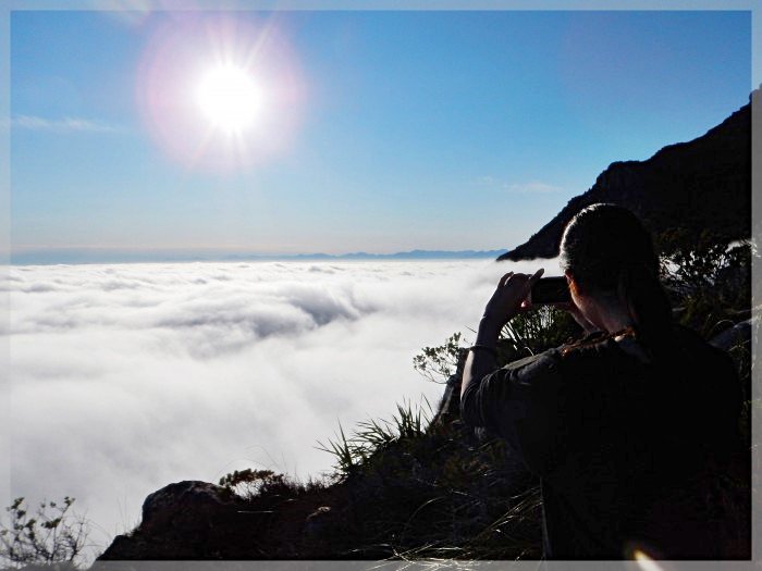
When there's little wind and the cloud is low, hike up through it. Once above, through cloud you'd be hard pressed to imagine a major city lies beneath you, except during load-shedding when so many generators growl below.
There are dozens of other options all around the mountain. If you are pressed for time there is bound to be a trail-head close to where you are staying. I'd be happy to help you make your choice.