Wandering the Widdringtonia wallichii
in ENDANGERED CAPE MOUNTAIN SHADE
Loop through a young cedar forest by taking the alternative lesser-walked Cedar Plantation Trail between Algeria and Middelbergvlakte on Daggavleikop's southern slope. It's a slightly longer way down, on a rougher path, so good shoes, enough water etc - But worth it.
CEDAR PLANTATION TRAIL
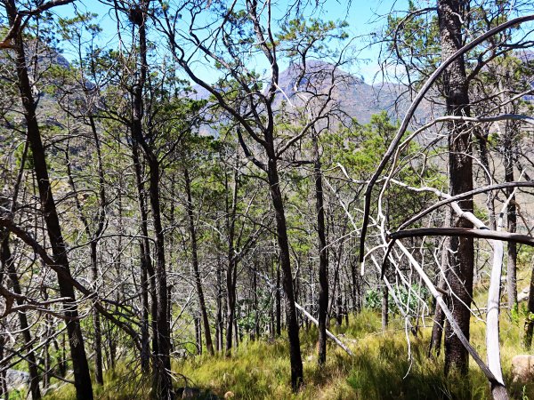
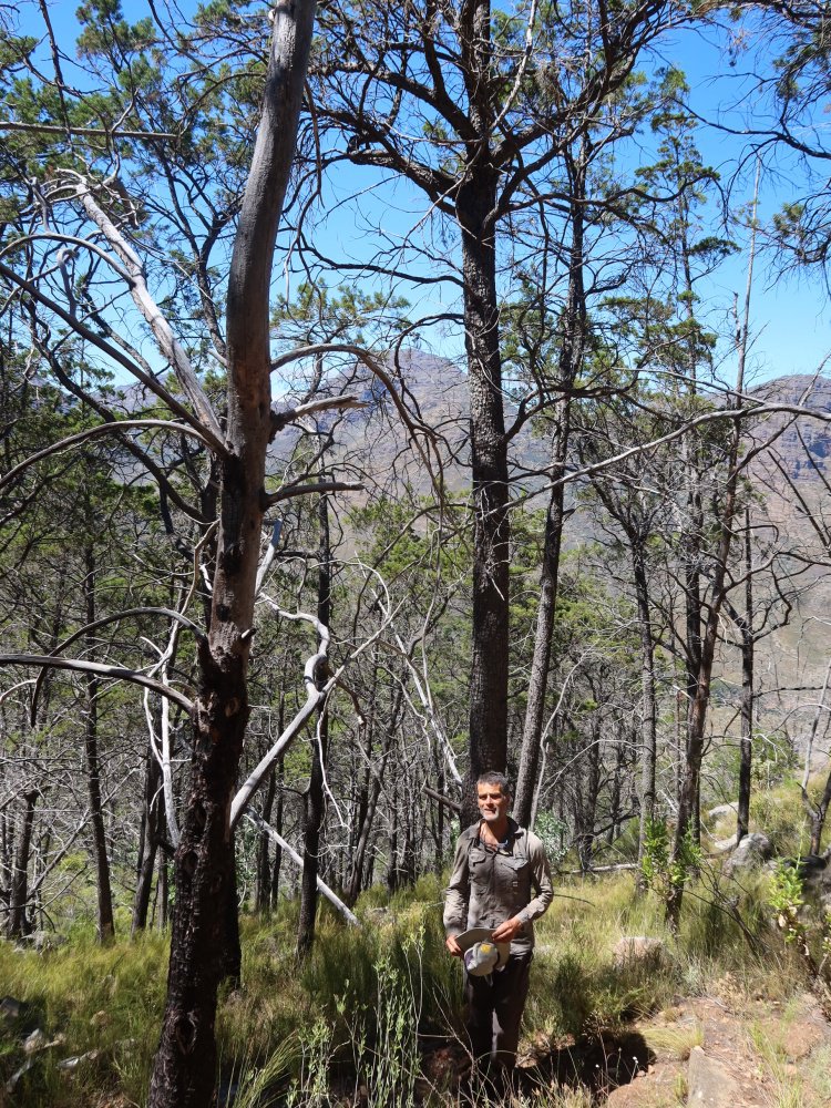
Seldom can one hike in the mountains that rim Africa's southern tip through cool dappled light and canopy rustlings of indigenous foliage. Apart from in verdant kloofs and gorges, the Cape Fold soil is not tree-friendly terrain. The outlier is the Cederberg. Only just.
Local Cedars on the edge of extinction.
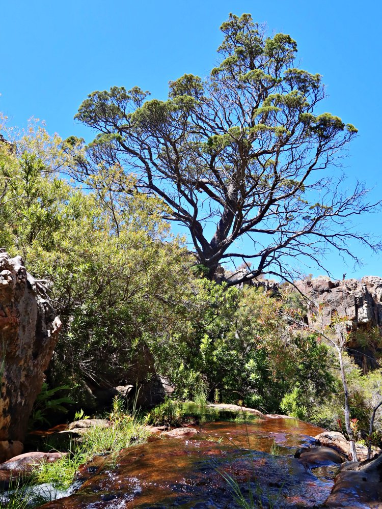
High in Cederberg's remote hard grandeur evolved vast forests of Widdringtonia wallichii. However, nineteenth century logging mania hit, robbing the Cape of a uniquely shaded mountain range, though leaving a strong network of paths.
Still to be seen in high crags, or in a few regenerative projects of small rough copses, any remaining cedar trees are in an adaptive time-chase against global heating, and more prosaic events:
Fire Too Often
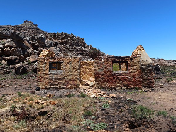
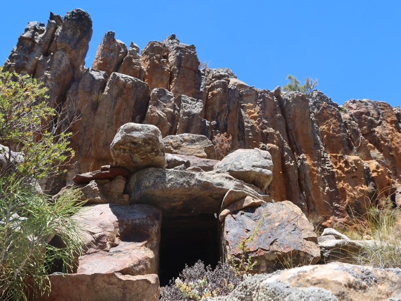
The blaze of late 2020 was allegedly sparked when used toilet paper was set alight up on the vlakte near Daggavleikop and Middleberg. (The hut pictured above didn't have a roof before the fire, and the main hut is barely intact. (As of late Jan 2025 the main hut's roof is no longer completly coverered.)
The 2020 blaze could also have been more ecologically consequential had it reached the cedar sanctuary, seen on the trail between the Middelburg and the Grootlandsvlakte, a stretch of veld with its own fire-damaged cedars, which is otherwise bouncing back from a fynbos blitz a few years back.
The hike
The Trail
A mostly distinct path, this alternative route between Algeria - Middelberg is looser underfoot than the main trail. Overgrowth sometimes hides clear pathway. Take care. Look out for the old leopard trap near the upper reaches.
Trap on the other side of the trail to where it's marked on the Slingsby chart.
Suggested Loop:
An early start up the main route when the sun hasn't yet crested Middleberg, means that once you've made the hard-walked ascent you will also be shaded by cedars for at least some of the way down.
Take the main route towards Middleberg Hut. Half way up you'll pass some lovely cedars. LOOK OUT FOR: About 5-10 min walk before getting to the hut there's a newly installed sign pointing to where you loop back down, (though the sign may not be there anymore. But there is a large cairn.
On the way take time in the shade.
Water.
Check out the waterfall. It runs all year.
Otherwise in the hot months, late summer especially, assume that running water will be scarce. It's there, probably, somewhere, but be self-reliant.
More on Cederberg's indigenous trees here.
Back to notes / info etc